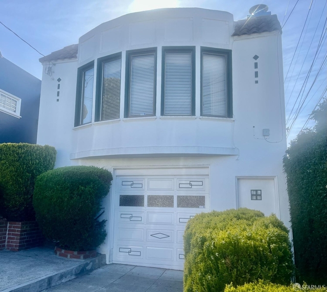
650 Upland Drive, San Francisco, CA 94127
Balboa Terrace, West of Twin Peaks, Southwest San Francisco, San Francisco
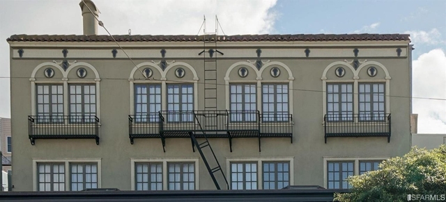
Nearby Active Listings
787 Head Street
Merced Heights, Ocean View, Southwest San Francisco, San Francisco
Welcome to 650 Upland Drive, a building located in Balboa Terrace, West of Twin Peaks, Southwest San Francisco, San Francisco in San Francisco, CA.
As a quick overview, these are the most up-to-date information we've collected about the property.
The building itself was built in 1927.
There are a total of 2 floors.
Finally, 650 Upland Drive was most recently sold on Apr 17, 2019 for $2,194,000.
According to local assessors, the total value of the building is currently valued at $2,352,140.
Specifically, the value of the land that the property sits on has been assessed at $1,646,499.
The building was last assessed in 2023.
Here's what we know about the features and amenities in this building.
While there is no garage access for residents, you will probably be able to find a local garage to park your car at instead.
We are not sure what system the building uses for cooling.
Sadly, informaton related to the heating system was not disclosed.
There is no porch or patio on the premise of the property.
For those who love to swim, you'll want to check out community pools nearby as this particular property does not have a swimming pool.
The local assessor's office has not provided us with information related to the roof cover material and the type of roof the building has.
Facts
Effective Year Built
1927
Building Condition
unknown
Exterior Walls Type
unknown
Interior Walls Type
unknown
Building
Property Class
Residential
Subdivision
BALBOA TERRACE ADD
Standard Land Use Code
Single family residential
County Land Use Code
unknown
Legal Description 1
MAP C6 13
Ownership
Current Owner
GWAK JINYOUNG DANIEL
Current Owner's Name
GWAK JINYOUNG DANIEL
Current Owner 2
QUINN DANIELLE MARIE
Current Owner 2's Name
GWAK QUINN D
Previous Owner
WENTKER FREDERICK W
Previous Owner 2
WENTKER JO ANN
Owner Address - City
TRUCKEE
Owner Address - ZIP Code
96161
Owner First Name
JINYOUNG
Second Owner First Name
QUINN
Second Owner Last Name
GWAK
Second Owner Middle Name
D
Neighborhood
School District Name
San Francisco Unified School District
Census - Combined Statistical Area - Area Code
488
Census - Combined Statistical Area - Area Name
San Jose-San Francisco-Oakland, CA
Census - County FIPS
06075
Census - Full FIPS
060750309002004
Census - Metropolitan Division - Area Code
41884
Census - Metropolitan Division - Area Name
San Francisco-San Mateo-Redwood City, CA
Census - Metro Micro Statistical Area - Area Code
41860
Census - Metro Micro Statistical Area - Area Name
San Francisco-Oakland-Berkeley, CA
Census - Metro Micro Statistical Area - Area Type
metropolitan
Census - Place FIPS
0667000
Census Source
US Census Bureau
School District - Unified - Grade High
12
School District - Unified - Grade Low
KG
School District - Unified - LEA Code
0634410
School District - Unified - Name
San Francisco Unified School District
Geography
Assessors Map Reference
13-B3
Mailing Carrier Code
R001
Mailing Full Street Address
15144 MARTIS PEAK RD
Mailing House Number
15144
Mailing Street
MARTIS PEAK
Mailing 4-Digit Zip Code
1457
Valuation
Timestamp
2023-09-06 06:11:27
More About The Building
In total, the building area is listed as 2,544 square feet.
The building itself has 2,544 square footage of total floor area.
Fun fact, were you aware that buildings can shift depending on temperatures outdoors? This might remind you of middle school science classes, but heat will cause most materials to expand while the cold will cause them to contract. As a result, many architects and engineers often have to make sure that control joints are made up of the right materials and in good condition.
The building class code for 650 Upland Drive is unknown but given the importance of this information, we will work to update this data as soon as possible.
Interested in learning more about the neighborhood that the property is located in?
Buildings in the West of Twin Peaks area have a median price of $2,950.
Those in the 25th percentile, have a price around $2,950.
While those in the 75th percentile, have a price around $2,950.
Typically, the buildings in this area have a median sqft of 800.
That means that the median price per sqft is around $4.
In other words, the price per sqft for buildings in the 25th percentile is $4.
While the price per sqft for buildings in the 75th percentile is $4.
As a breakdown, we've included the following stats:
- There are currently no studio listings being advertised in the area.
- There are currently a total of 2 one bedroom listings.
The median price for these types of listings is $2,950.
That's $3.69 price per sqft.
- There are currently no two bedroom listings being advertised in the area.
- There are currently no three bedroom listings being advertised in the area.
- There are currently no four bedroom listings being advertised in the area.
About The Area
650 Upland Drive is located in San Francisco County, California.
There are 850,282 people living here.
There are 356,797 households.
Most of these households have an average family size of 3.14 people.
According to the census, 63% are currently renting while 37% own their homes.
The median age of this population is around 38.4 years old.
On average, most folks in the county are unmarried.
About 44% of folks speak a language other than English in this area.
The area's employment rate is currently around 65.4%.
Speaking of employment, the median income is $87,701.
Most folks will commute by car for around 32.4 minutes.
Finally, we know that 12% of residents in the area have graduated with their high school degree.
Additionally, 33% and 22% have their Bachelor's and Master's degree, respectfully.
Moving on to the urban area level.
San Francisco - Oakland, CA Urban Area has a population of 3,453,623 people.
Based on census records, there are 1,277,557 registered households.
Families in this area are on average made up of 3.32 people per household.
Most folks are unmarried.
They are also typically around 38.4 years old.
Does diversity matter to you? Right now, 44% of folks speak a language other than English here.
About 51% rent while 49% purchased their homes.
Right now, the community is made up of 16% of residents who have graduated with at least a high school degree.
On top of that, 28% have a Bachelor's degree and 19% have a Master's degree.
The employment rate is currently around 63%.
Those employed, have a median income of $82,958.
If you move here, you can expect to commute mostly by car for around 31.0 minutes.
PUBLIC TRANSIT
Ocean Ave & San Leandro Way
(690 ft - 3 min walk)
San Francisco Municipal Transportation Agency
Ocean Ave & San Leandro Way
(800 ft - 3 min walk)
San Francisco Municipal Transportation Agency
Ocean Ave & Aptos Ave
(850 ft - 4 min walk)
San Francisco Municipal Transportation Agency
Ocean Ave & Aptos Ave
(850 ft - 4 min walk)
San Francisco Municipal Transportation Agency
Monterey Blvd & San Aleso Ave
(900 ft - 4 min walk)
San Francisco Municipal Transportation Agency
Nearby Schools
(within attendance boundary)
50 Darien Way, San Francisco, CA 94127
Public
•
Elementary
•
Grades KG to 5
San Francisco Unified School District
105 Aptos Ave., San Francisco, CA 94127
Public
•
Middle School
•
Grades 6 to 8
San Francisco Unified School District
555 Portola Dr., San Francisco, CA 94131
Public
•
High School
•
Grades 9 to 12
San Francisco Unified School District
School zoning information and other data are provided by
RealtyHop Schools and 3rd party sources.
The contents of the database are not guaranteed to be accurate or timely.
Contact the schools or districts before making any decisions using on this data.