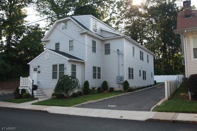
Welcome to 65 High Point Drive, a building located in Union in Springfield, NJ.
As a quick overview, these are the most up-to-date information we've collected about the property.
The building itself was built in 1955.
This is a single story building.
Finally, 65 High Point Drive was most recently sold on Apr 24, 1995 for $210,000.
The market value for the land that the building sits on has been listed at $301,800.
In addition, improvements upon the building have an added value of $321,300.
In total, the total market value of the property as a whole is $623,100.
According to local assessors, the total value of the building is currently valued at $623,100.
Specifically, the value of the land that the property sits on has been assessed at $301,800.
The building was last assessed in 2023.
Here's what we know about the features and amenities in this building.
While there is no garage access for residents, you will probably be able to find a local garage to park your car at instead.
We are not sure what system the building uses for cooling.
Sadly, informaton related to the heating system was not disclosed.
There is no porch or patio on the premise of the property.
For those who love to swim, you'll want to check out community pools nearby as this particular property does not have a swimming pool.
The local assessor's office has not provided us with information related to the roof cover material and the type of roof the building has.
Facts
General
Year Built
1955
Effective Year Built
1955
Bedroom Count
0
Building Condition
unknown
Building Quality
unknown
Construction Type
Wood
Building Style
Cape Cod
Exterior Walls Type
Wood
Interior Walls Type
unknown
Roof Shape Type
unknown
Roof Cover Type
unknown
Floor Count
1
Living Units
1
Floor Cover
unknown
Basement Type
unknown
Basement Area
0
Garage Type
Garage
Parking Space Count
2
Patio Type
unknown
Porch Type
unknown
Pool Type
unknown
Unit Count
Building Floor Area
Floor Area Ratios
Building
Building Type
unknown
Property Class
Residential
Land Acres
0.445
Standard Land Use Code
Single family residential
County Land Use Code
unknown
Ownership
Current Owner
SHLIECHKORN DALIA
Current Owner's Name
SHLIECHKORN DALIA
Previous Owner
CARTY PATRICIA
Previous Owner 2
LOEFFLER ELLA
Owner Address - City
LIVINGSTON
Owner Address - State
NJ
Owner Address - ZIP Code
07039
Owner First Name
DALIA
Owner Last Name
SHLIECHKORN
Neighborhood
School District Name
Springfield Township School District
Census Tract
037601
Census Block Code
2021
Census Group
2
Census Year
2022
Census - Combined Statistical Area - Area Code
408
Census - Combined Statistical Area - Area Name
New York-Newark, NY-NJ-CT-PA
Census - County FIPS
34039
Census - Full FIPS
340390376012021
Census - Metropolitan Division - Area Code
35084
Census - Metropolitan Division - Area Name
Newark, NJ-PA
Census - Metro Micro Statistical Area - Area Code
35620
Census - Metro Micro Statistical Area - Area Name
New York-Newark-Jersey City, NY-NJ-PA
Census - Metro Micro Statistical Area - Area Type
metropolitan
Census Source
US Census Bureau
Census State FIPS
34
Census Tract Code
037601
School District - Unified - Grade High
12
School District - Unified - Grade Low
KG
School District - Unified - LEA Code
3415630
School District - Unified - Name
Springfield Township School District
Zoning
Geography
District
17
Parcel
17 03208-0000-00009
Block
3208
Lot
9
Lot Code
unknown
Municipality
SPRINGFIELD TWP
Latitude
40.697
Longitude
-74.3498
FIPS
34039
Mailing Carrier Code
C021
Mailing Full Street Address
50 FORCE HILL RD
Mailing House Number
50
Mailing Street Mode
RD
Mailing Street
FORCE HILL
Mailing 4-Digit Zip Code
1505
Geo Status Code
unknown
Valuation
Timestamp
2024-04-11 19:39:57
UCID Flag
C
More About The Building
In total, the building area is listed as 1,796 square feet.
Fun fact, were you aware that buildings can shift depending on temperatures outdoors? This might remind you of middle school science classes, but heat will cause most materials to expand while the cold will cause them to contract. As a result, many architects and engineers often have to make sure that control joints are made up of the right materials and in good condition.
The building class code for 65 High Point Drive is unknown but given the importance of this information, we will work to update this data as soon as possible.
Interested in learning more about the neighborhood that the property is located in?
Buildings in the Union area have a median price of $2,825.
Those in the 25th percentile, have a price around $2,300.
While those in the 75th percentile, have a price around $3,688.
Typically, the buildings in this area have a median sqft of 1,550.
That means that the median price per sqft is around $2.
In other words, the price per sqft for buildings in the 25th percentile is $2.
While the price per sqft for buildings in the 75th percentile is $3.
As a breakdown, we've included the following stats:
There are currently a total of 6 studio listings.
The median price for these types of listings is $2,925.
There are currently a total of 38 one bedroom listings.
The median price for these types of listings is $1,925.
That's $2.80 price per sqft.
There are currently a total of 80 two bedroom listings.
The median price for these types of listings is $2,450.
That's $2.19 price per sqft.
There are currently a total of 86 three bedroom listings.
The median price for these types of listings is $2,973.
That's $1.95 price per sqft.
There are currently a total of 52 four bedroom listings.
The median price for these types of listings is $4,500.
That's $2.00 price per sqft.
About The Area
65 High Point Drive is located in New York - Newark, NY - NJ - CT Urban Area.
There are 18,812,161 people living here.
There are 6,707,347 households.
Most of these households have an average family size of 3.42 people.
According to the census, 50% are currently renting while 50% own their homes.
The median age of this population is around 37.8 years old.
On average, most folks in the urban area are unmarried.
About 40% of folks speak a language other than English in this area.
The area's employment rate is currently around 59.7%.
Speaking of employment, the median income is $68,319.
Most folks will commute by car for around 36.0 minutes.
Finally, we know that 25% of residents in the area have graduated with their high school degree.
Additionally, 22% and 16% have their Bachelor's and Master's degree, respectfully.
School zoning information and other data are provided by
RealtyHop Schools and 3rd party sources.
The contents of the database are not guaranteed to be accurate or timely.
Contact the schools or districts before making any decisions using on this data.