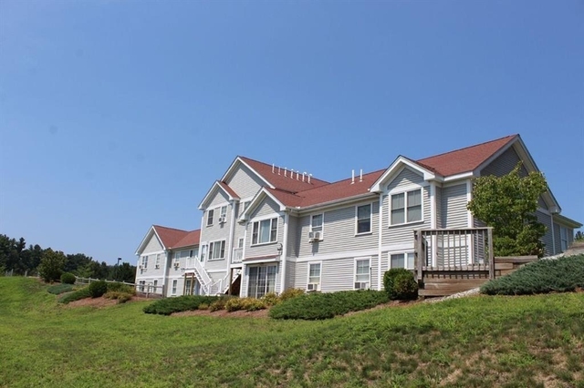
Welcome to 34 North Street, a building located in Westford in Westford, MA.
As a quick overview, these are the most up-to-date information we've collected about the property.
The building itself was built in 1953.
This is a single story building.
According to local assessors, the total value of the building is currently valued at $459,900.
Specifically, the value of the land that the property sits on has been assessed at $318,700.
The building was last assessed in 2024.
Here's what we know about the features and amenities in this building.
While there is no garage access for residents, you will probably be able to find a local garage to park your car at instead.
We are not sure what system the building uses for cooling.
Sadly, informaton related to the heating system was not disclosed.
There is no porch or patio on the premise of the property.
For those who love to swim, you'll want to check out community pools nearby as this particular property does not have a swimming pool.
The local assessor's office has not provided us with information related to the roof cover material and the type of roof the building has.
Policies
Cats Allowed
Dogs Allowed
Facts
General
Year Built
1953
Effective Year Built
1953
Building Count
1
Total Rooms
4
Bedroom Count
2
Bathroom Count
1
Full Bathrooms
1
Partial Bathrooms
1
Building Condition
Average
Building Quality
unknown
Construction Type
Frame
Building Style
Ranch/Rambler
Exterior Walls Type
Alum/Vinyl siding
Interior Walls Type
unknown
Roof Shape Type
Gable
Roof Cover Type
Asphalt
Floor Count
1
Living Units
1
Floor Cover
unknown
Basement Type
Unfinished basement
Basement Area
1,008
Garage Type
Underground/basement
Parking Space Count
1
Patio Type
unknown
Porch Type
unknown
Pool Type
unknown
Unit Count
Building Floor Area
Floor Area Ratios
Building
Building Type
unknown
Property Class
Residential
Land Acres
2.51
Standard Land Use Code
Single family residential
County Land Use Code
unknown
Ownership
Current Owner
T DC
Current Owner's Name
MOULTON DAVID C
Current Owner 2
NJ T
Current Owner 2's Name
MOULTON JEANNE M
Previous Owner
MOULTON NANCY J
Owner Address - City
WESTFORD
Owner Address - State
MA
Owner Address - ZIP Code
01886
Owner First Name
DAVID
Owner Last Name
MOULTON
Owner Middle Name
C
Second Owner First Name
JEANNE
Second Owner Last Name
MOULTON
Second Owner Middle Name
M
Is Owner Occupied
Owner-occupied property
Neighborhood
School District Name
Westford School District
Census Tract
318200
Census Block Code
1020
Census Group
1
Census Year
2023
Census - Combined Statistical Area - Area Code
148
Census - Combined Statistical Area - Area Name
Boston-Worcester-Providence, MA-RI-NH
Census - County FIPS
25017
Census - Full FIPS
250173182001020
Census - Metropolitan Division - Area Code
15764
Census - Metropolitan Division - Area Name
Cambridge-Newton-Framingham, MA
Census - Metro Micro Statistical Area - Area Code
14460
Census - Metro Micro Statistical Area - Area Name
Boston-Cambridge-Newton, MA-NH
Census - Metro Micro Statistical Area - Area Type
metropolitan
Census Source
US Census Bureau
Census State FIPS
25
Census Tract Code
318200
School District - Unified - Grade High
12
School District - Unified - Grade Low
PK
School District - Unified - LEA Code
2512660
School District - Unified - Name
Westford School District
Zoning
Zoning
RA
Geography
Parcel
WFOR M:0035.0 P:0086 S:0000
Lot Code
unknown
Municipality
WESTFORD
Latitude
42.6025
Longitude
-71.4675
FIPS
25017
Mailing Carrier Code
R002
Mailing Full Street Address
34 NORTH ST
Mailing House Number
34
Mailing Street Mode
ST
Mailing Street
NORTH
Mailing 4-Digit Zip Code
1247
Geo Status Code
unknown
Valuation
Timestamp
2024-01-25 21:40:19
UCID Flag
C
More About The Building
In total, the building area is listed as 1,008 square feet.
The building itself has 2,016 square footage of total floor area.
Fun fact, were you aware that buildings can shift depending on temperatures outdoors? This might remind you of middle school science classes, but heat will cause most materials to expand while the cold will cause them to contract. As a result, many architects and engineers often have to make sure that control joints are made up of the right materials and in good condition.
The building class code for 34 North Street is unknown but given the importance of this information, we will work to update this data as soon as possible.
Interested in learning more about the neighborhood that the property is located in?
Buildings in the Middlesex area have a median price of $3,324.
Those in the 25th percentile, have a price around $2,885.
While those in the 75th percentile, have a price around $3,950.
Typically, the buildings in this area have a median sqft of 878.
That means that the median price per sqft is around $4.
In other words, the price per sqft for buildings in the 25th percentile is $3.
While the price per sqft for buildings in the 75th percentile is $5.
As a breakdown, we've included the following stats:
There are currently a total of 55 studio listings.
The median price for these types of listings is $2,820.
That's $5.16 price per sqft.
There are currently a total of 196 one bedroom listings.
The median price for these types of listings is $2,949.
That's $4.08 price per sqft.
There are currently a total of 208 two bedroom listings.
The median price for these types of listings is $3,607.
That's $3.26 price per sqft.
There are currently a total of 40 three bedroom listings.
The median price for these types of listings is $3,700.
That's $3.12 price per sqft.
There are currently a total of 26 four bedroom listings.
The median price for these types of listings is $6,525.
That's $3.04 price per sqft.
About The Area
34 North Street is located in Boston, MA - NH - RI Urban Area.
There are 4,343,828 people living here.
There are 1,635,254 households.
Most of these households have an average family size of 3.19 people.
According to the census, 40% are currently renting while 60% own their homes.
The median age of this population is around 38.2 years old.
On average, most folks in the urban area are unmarried.
About 26% of folks speak a language other than English in this area.
The area's employment rate is currently around 64.5%.
Speaking of employment, the median income is $77,009.
Most folks will commute by car for around 30.7 minutes.
Finally, we know that 23% of residents in the area have graduated with their high school degree.
Additionally, 25% and 20% have their Bachelor's and Master's degree, respectfully.
School zoning information and other data are provided by
RealtyHop Schools and 3rd party sources.
The contents of the database are not guaranteed to be accurate or timely.
Contact the schools or districts before making any decisions using on this data.