33 Baker Drive, West Long Branch, NJ 07764
West Long Branch, Monmouth
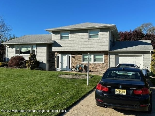
Nearby Active Listings
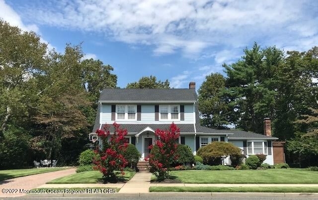

Welcome to 33 Baker Drive, a building located in West Long Branch, Monmouth in West Long Branch, NJ.
As a quick overview, these are the most up-to-date information we've collected about the property.
The building itself was built in 1949.
This is a single story building.
Finally, 33 Baker Drive was most recently sold on Sep 19, 2019 for $480,000.
The market value for the land that the building sits on has been listed at $621,500.
In addition, improvements upon the building have an added value of $310,300.
In total, the total market value of the property as a whole is $931,800.
According to local assessors, the total value of the building is currently valued at $931,800.
Specifically, the value of the land that the property sits on has been assessed at $621,500.
The building was last assessed in 2023.
Here's what we know about the features and amenities in this building.
While there is no garage access for residents, you will probably be able to find a local garage to park your car at instead.
We are not sure what system the building uses for cooling.
Sadly, informaton related to the heating system was not disclosed.
Are you a fan of fireplaces? Good news! This property has one single fireplace.
There is no porch or patio on the premise of the property.
For those who love to swim, you'll want to check out community pools nearby as this particular property does not have a swimming pool.
The local assessor's office has not provided us with information related to the roof cover material and the type of roof the building has.
Facts
Effective Year Built
1949
Building Style
Ranch/Rambler
Exterior Walls Type
Alum/Vinyl siding
Interior Walls Type
unknown
Roof Cover Type
Shingle (not wood)
Basement Type
Unspecified basement
Building
Property Class
Residential
Standard Land Use Code
Single family residential
County Land Use Code
unknown
Legal Description 1
ADDITIONAL LOTS: 15
Ownership
Current Owner
COHEN ALBERT
Current Owner's Name
NOT AVAILABLE FROM THE COUNTY
Current Owner 2
COHEN ESTHER
Previous Owner
ERCOLINO BUILDERS & DEVELOPERS LLC
Previous Owner's Name
ERCOLINO BUILDERS & DEVELOPERS LLC
Owner Address - City
WEST LONG BRANCH
Owner Address - ZIP Code
07764
Owner Before Previous Owner
RTIZ ROBET
Owner Before Previous Owner 2
CALLINAN JOHN W
Current Owner Is a Corporation Indicator
Yes
Neighborhood
School District Name
West Long Branch Borough School District
Census - Combined Statistical Area - Area Code
408
Census - Combined Statistical Area - Area Name
New York-Newark, NY-NJ-CT-PA
Census - County FIPS
34025
Census - Full FIPS
340258062012029
Census - Metropolitan Division - Area Code
35154
Census - Metropolitan Division - Area Name
New Brunswick-Lakewood, NJ
Census - Metro Micro Statistical Area - Area Code
35620
Census - Metro Micro Statistical Area - Area Name
New York-Newark-Jersey City, NY-NJ-PA
Census - Metro Micro Statistical Area - Area Type
metropolitan
Census - Place FIPS
3479310
Census Source
US Census Bureau
School District - Secondary - Grade High
12
School District - Secondary - Grade Low
09
School District - Secondary - LEA Code
3414940
School District - Secondary - Name
Shore Regional School District
Geography
Assessors Map Reference
TAX MAP 14
Parcel
53 00057-0000-00014
Municipality
WEST LONG BRANCH BORO
Mailing Carrier Code
C001
Mailing Full Street Address
33 BAKER DR
Mailing 4-Digit Zip Code
1701
Valuation
Timestamp
2024-04-12 22:13:30
More About The Building
In total, the building area is listed as 1,159 square feet.
The depth of the property lot was measured at 970 square feet and the front at 1,000 square feet.
Fun fact, were you aware that buildings can shift depending on temperatures outdoors? This might remind you of middle school science classes, but heat will cause most materials to expand while the cold will cause them to contract. As a result, many architects and engineers often have to make sure that control joints are made up of the right materials and in good condition.
The building class code for 33 Baker Drive is unknown but given the importance of this information, we will work to update this data as soon as possible.
Interested in learning more about the neighborhood that the property is located in?
Buildings in the West Long Branch area have a median price of $4,050.
Those in the 25th percentile, have a price around $3,000.
While those in the 75th percentile, have a price around $36,500.
Typically, the buildings in this area have a median sqft of 2,125.
That means that the median price per sqft is around $2.
In other words, the price per sqft for buildings in the 25th percentile is $1.
While the price per sqft for buildings in the 75th percentile is $19.
As a breakdown, we've included the following stats:
- There are currently no studio listings being advertised in the area.
- There are currently no one bedroom listings being advertised in the area.
- There are currently a total of 2 two bedroom listings.
The median price for these types of listings is $16,375.
That's $10.37 price per sqft.
- There are currently a total of 20 three bedroom listings.
The median price for these types of listings is $3,000.
That's $1.97 price per sqft.
- There are currently a total of 58 four bedroom listings.
The median price for these types of listings is $4,350.
That's $1.87 price per sqft.
About The Area
33 Baker Drive is located in Monmouth County, New Jersey.
There are 627,532 people living here.
There are 232,868 households.
Most of these households have an average family size of 3.25 people.
According to the census, 26% are currently renting while 74% own their homes.
The median age of this population is around 42.6 years old.
On average, most folks in the county are married.
About 18% of folks speak a language other than English in this area.
The area's employment rate is currently around 61.2%.
Speaking of employment, the median income is $87,297.
Most folks will commute by car for around 33.6 minutes.
Finally, we know that 25% of residents in the area have graduated with their high school degree.
Additionally, 26% and 17% have their Bachelor's and Master's degree, respectfully.
Moving on to the urban area level.
New York - Newark, NY - NJ - CT Urban Area has a population of 18,812,161 people.
Based on census records, there are 6,707,347 registered households.
Families in this area are on average made up of 3.42 people per household.
Most folks are unmarried.
They are also typically around 37.8 years old.
Does diversity matter to you? Right now, 40% of folks speak a language other than English here.
About 50% rent while 50% purchased their homes.
Right now, the community is made up of 25% of residents who have graduated with at least a high school degree.
On top of that, 22% have a Bachelor's degree and 16% have a Master's degree.
The employment rate is currently around 59.7%.
Those employed, have a median income of $68,319.
Nearby Schools
(within attendance boundary)
20 Parker Road, West Long Branch, NJ 07764
Public
•
Elementary
•
Grades PK to 4
West Long Branch Borough School District
135 Locust Avenue, West Long Branch, NJ 07764
Public
•
Middle School
•
Grades 5 to 8
West Long Branch Borough School District
132 Monmouth Park Highway 36, West Long Branch, NJ 07764
Public
•
High School
•
Grades 9 to 12
Shore Regional School District
School zoning information and other data are provided by
RealtyHop Schools and 3rd party sources.
The contents of the database are not guaranteed to be accurate or timely.
Contact the schools or districts before making any decisions using on this data.