318 West 7th Street, Kansas City, MO 64105
Garment District, The Downtown Loop, Downtown Kansas City, Jackson
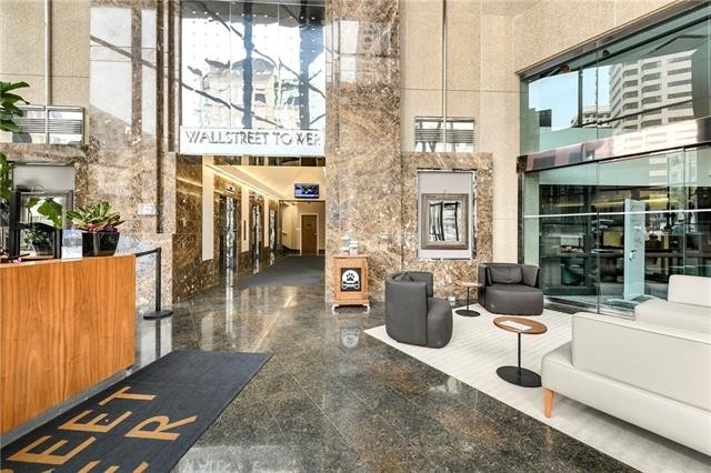
Nearby Active Listings
Welcome to 318 West 7th Street, a building located in Garment District, The Downtown Loop, Downtown Kansas City, Jackson in Kansas City, MO.
As a quick overview, these are the most up-to-date information we've collected about the property.
The building itself was built in 1916.
This is a relatively tall building with a total of 7 floors.
Finally, 318 West 7th Street was most recently sold on Dec 22, 2021 for $98,932,000.
In total, the total market value of the property as a whole is $3,690,000.
According to local assessors, the total value of the building is currently valued at $701,100.
Specifically, the value of the land that the property sits on has been assessed at $45,078.
The building was last assessed in 2022.
There are another one buildings located on the same land that 318 West 7th Street was built on.
Here's what we know about the features and amenities in this building.
While there is no garage access for residents, you will probably be able to find a local garage to park your car at instead.
We are not sure what system the building uses for cooling.
Sadly, informaton related to the heating system was not disclosed.
There is no porch or patio on the premise of the property.
For those who love to swim, you'll want to check out community pools nearby as this particular property does not have a swimming pool.
The local assessor's office has not provided us with information related to the roof cover material and the type of roof the building has.
Policies
Cats Allowed
Dogs Allowed
Facts
Effective Year Built
1970
Building Condition
Average
Exterior Walls Type
Brick veneer
Interior Walls Type
unknown
Location Influence Type
unknown
Building
Property Class
Residential
Subdivision
KINGS RESURVEY OF HUBBARDS ADD
Standard Land Use Code
Apartments (generic)
County Land Use Code
unknown
Legal Description 1
KINGS RES OF HUBBARDS ADD LOTS 12-13-14-15 & 16 BLK 7
Ownership
Current Owner
KC LOFTS WEST SEVENTH OWNER LLC
Current Owner's Name
KC LOFTS WEST SEVENTH OWNER LLC
Previous Owner
WEST SEVENTH STREET LOFTS LLC
Owner Address - City
NEW YORK
Owner Address - ZIP Code
10038
Ownership Rights Codes
unknown
Current Owner Is a Corporation Indicator
Yes
Neighborhood
School District Name
Kansas City 33 School District
Census - Combined Statistical Area - Area Code
312
Census - Combined Statistical Area - Area Name
Kansas City-Overland Park-Kansas City, MO-KS
Census - County FIPS
29095
Census - Full FIPS
290950157002010
Census - Metro Micro Statistical Area - Area Code
28140
Census - Metro Micro Statistical Area - Area Name
Kansas City, MO-KS
Census - Metro Micro Statistical Area - Area Type
metropolitan
Census - Place FIPS
2938000
Census Source
US Census Bureau
School District - Unified - Grade High
12
School District - Unified - Grade Low
PK
School District - Unified - LEA Code
2916400
School District - Unified - Name
Kansas City 33 School District
Geography
Assessors Map Reference
29-220
Parcel
29-220-08-03-00-0-00-000
Mailing Carrier Code
C018
Mailing Full Street Address
160 BROADWAY RM 501
Mailing 4-Digit Zip Code
4218
Geo Status Code
Prior to setting the GEOsource field the default value was 'P'.
Valuation
Timestamp
2024-03-27 04:07:39
More About The Building
In total, the building area is listed as 23,146 square feet.
The building itself has 23,146 square footage of total floor area.
Fun fact, were you aware that buildings can shift depending on temperatures outdoors? This might remind you of middle school science classes, but heat will cause most materials to expand while the cold will cause them to contract. As a result, many architects and engineers often have to make sure that control joints are made up of the right materials and in good condition.
The building class code for 318 West 7th Street is unknown but given the importance of this information, we will work to update this data as soon as possible.
Interested in learning more about the neighborhood that the property is located in?
Buildings in the The Downtown Loop area have a median price of $2,500.
Those in the 25th percentile, have a price around $2,500.
While those in the 75th percentile, have a price around $2,500.
As a breakdown, we've included the following stats:
- There are currently no studio listings being advertised in the area.
- There are currently no one bedroom listings being advertised in the area.
- There is currently a single advertised two bedroom listing.
- There are currently no three bedroom listings being advertised in the area.
- There are currently no four bedroom listings being advertised in the area.
About The Area
318 West 7th Street is located in 64106.
There are 9,092 people living here.
There are 3,687 households.
Most of these households have an average family size of 3.43 people.
According to the census, 82% are currently renting while 18% own their homes.
The median age of this population is around 28.9 years old.
On average, most folks in the zipcode are unmarried.
About 23% of folks speak a language other than English in this area.
The area's employment rate is currently around 52%.
Speaking of employment, the median income is $28,449.
Most folks will commute by car for around 19.8 minutes.
Finally, we know that 24% of residents in the area have graduated with their high school degree.
Additionally, 17% and 11% have their Bachelor's and Master's degree, respectfully.
Moving on to the county level.
Jackson County, Missouri has a population of 683,643 people.
Based on census records, there are 276,857 registered households.
Families in this area are on average made up of 3.15 people per household.
Most folks are unmarried.
They are also typically around 36.5 years old.
Does diversity matter to you? Right now, 9% of folks speak a language other than English here.
About 42% rent while 58% purchased their homes.
Right now, the community is made up of 29% of residents who have graduated with at least a high school degree.
On top of that, 19% have a Bachelor's degree and 11% have a Master's degree.
The employment rate is currently around 61.9%.
Those employed, have a median income of $48,104.
If you move here, you can expect to commute mostly by car for around 23.0 minutes.
Finally, let's take a look at the stats related to Kansas City, MO - KS Urban Area.
The urban area is home to 1,565,407 people.
A total of 618,037 households are registered here.
With average family sizes being listed at 3.16 people.
About 24% of residents have graduated with a high school degree.
Of the rest, 23% have their Bachelor's and 14% have their Master's degree.
Folks speaking a language other than English, make up about 12% of the population.
Looking to move to this urban area? You'll need to look forward to commuting by car for around 21.8 minutes.
Speaking of your commute, 64.9% of people in this area are employed.
The recorded median income is currently at $57,126 per year.
The median population age has been listed at 36.2 years old.
Interestingly enough, unmarried people make up the majority of the population.
Last but not least, renters make up about 38% of the population while homeowners are at about 62% of the population.
PUBLIC TRANSIT
ON BROADWAY AT 8TH NORTHBOUND FARSIDE
(510 ft - 3 min walk)
KCATA
ON BROADWAY AT 8TH SOUTHBOUND
(550 ft - 3 min walk)
KCATA
NORTH LOOP ON MAIN AT 7TH ST SB
(0.21 mi - 5 min walk)
KCATA
ON W 3RD AT BROADWAY BLVD WB
(0.22 mi - 5 min walk)
KCATA
ON W 4TH AT WASHINGTON EB
(0.22 mi - 5 min walk)
KCATA
Nearby Schools
(within attendance boundary)
1000 W 17th St, Kansas City, MO 64108
Public
•
Elementary
•
Grades PK to 6
Kansas City 33 School District
4904 Independence Avenue, Kansas City, MO 64124
Public
•
Middle School
•
Grades 7 to 8
Kansas City 33 School District
415 S Van Brunt, Kansas City, MO 64124
Public
•
High School
•
Grades 9 to 12
Kansas City 33 School District
School zoning information and other data are provided by
RealtyHop Schools and 3rd party sources.
The contents of the database are not guaranteed to be accurate or timely.
Contact the schools or districts before making any decisions using on this data.


