315 East 5th Street, Davenport, IA 52801
Crescent Warehouse Historic District, Central Davenport, Scott
Nearby Active Listings
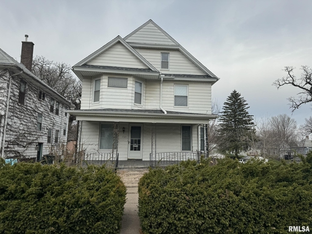
Welcome to 315 East 5th Street, a building located in Crescent Warehouse Historic District, Central Davenport, Scott in Davenport, IA.
As a quick overview, these are the most up-to-date information we've collected about the property.
The building itself was built in 1918.
There are a total of 3 floors.
Finally, 315 East 5th Street was most recently sold on Oct 22, 2020 for $1,400,000.
The market value for the land that the building sits on has been listed at $14,400.
In addition, improvements upon the building have an added value of $1,328,250.
In total, the total market value of the property as a whole is $1,342,650.
According to local assessors, the total value of the building is currently valued at $1,342,650.
Specifically, the value of the land that the property sits on has been assessed at $14,400.
The building was last assessed in 2023.
Here's what we know about the features and amenities in this building.
While there is no garage access for residents, you will probably be able to find a local garage to park your car at instead.
We are not sure what system the building uses for cooling.
Sadly, informaton related to the heating system was not disclosed.
There is no porch or patio on the premise of the property.
For those who love to swim, you'll want to check out community pools nearby as this particular property does not have a swimming pool.
The local assessor's office has not provided us with information related to the roof cover material and the type of roof the building has.
Policies
Cats Allowed
Dogs Allowed
Facts
Effective Year Built
1918
Building Condition
Unsound
Construction Type
unknown
Exterior Walls Type
Brick
Interior Walls Type
unknown
Basement Type
Unspecified basement
Building
Building Type
Wood &/or steel frames
Property Class
Residential
Subdivision
LECLAIRE'S 4TH ADD
Standard Land Use Code
Apartments (generic)
County Land Use Code
unknown
Legal Description 1
LECLAIRE'S 4TH ADD LOT: 008 BLOCK: 067 LECLAIRE'S 4TH ADDE/2 OF
Ownership
Current Owner
ABG KERKER LOFTS LLC
Current Owner's Name
ABG KERKER LOFTS LLC
Previous Owner
KERKER LOFTS LLC
Owner Address - City
CHICAGO
Owner Address - ZIP Code
60602
Ownership Rights Codes
Company/Corporation
Current Owner Is a Corporation Indicator
Yes
Neighborhood
School District Name
Davenport Community School District
School Tax School District
DAVENPORT
Census - Combined Statistical Area - Area Code
209
Census - Combined Statistical Area - Area Name
Davenport-Moline, IA-IL
Census - County FIPS
19163
Census - Full FIPS
191630106003026
Census - Metro Micro Statistical Area - Area Code
19340
Census - Metro Micro Statistical Area - Area Name
Davenport-Moline-Rock Island, IA-IL
Census - Metro Micro Statistical Area - Area Type
metropolitan
Census - Place FIPS
1919000
Census Source
US Census Bureau
School District - Unified - Grade High
12
School District - Unified - Grade Low
KG
School District - Unified - LEA Code
1908580
School District - Unified - Name
Davenport Community School District
Geography
Assessors Map Reference
PM F0064-30
Municipality
DAVENPORT EXP
Mailing Carrier Code
C023
Mailing Street Direction
N
Mailing Full Street Address
134 N LA SALLE ST STE 1950
Mailing 4-Digit Zip Code
1144
Geo Status Code
Prior to setting the GEOsource field the default value was 'P'.
Valuation
Timestamp
2023-12-19 23:47:10
More About The Building
In total, the building area is listed as 14,496 square feet.
The building itself has 14,496 square footage of total floor area.
Fun fact, were you aware that buildings can shift depending on temperatures outdoors? This might remind you of middle school science classes, but heat will cause most materials to expand while the cold will cause them to contract. As a result, many architects and engineers often have to make sure that control joints are made up of the right materials and in good condition.
The building class code for 315 East 5th Street is unknown but given the importance of this information, we will work to update this data as soon as possible.
Interested in learning more about the neighborhood that the property is located in?
Buildings in the Crescent Warehouse Historic District area have a median price of $1,105.
Those in the 25th percentile, have a price around $1,105.
While those in the 75th percentile, have a price around $1,105.
Typically, the buildings in this area have a median sqft of 915.
That means that the median price per sqft is around $1.
In other words, the price per sqft for buildings in the 25th percentile is $1.
While the price per sqft for buildings in the 75th percentile is $1.
As a breakdown, we've included the following stats:
- There are currently no studio listings being advertised in the area.
- There is currently a single advertised one bedroom listing.
- There are currently no two bedroom listings being advertised in the area.
- There are currently no three bedroom listings being advertised in the area.
- There are currently no four bedroom listings being advertised in the area.
About The Area
315 East 5th Street is located in 52801.
There are 1,015 people living here.
There are 549 households.
Most of these households have an average family size of 2.28 people.
According to the census, 99% are currently renting while 1% own their homes.
The median age of this population is around 31.4 years old.
On average, most folks in the zipcode are unmarried.
About 6% of folks speak a language other than English in this area.
The area's employment rate is currently around 43.3%.
Speaking of employment, the median income is $25,817.
Most folks will commute by car for around 15.8 minutes.
Finally, we know that 27% of residents in the area have graduated with their high school degree.
Additionally, 17% and 11% have their Bachelor's and Master's degree, respectfully.
Moving on to the county level.
Scott County, Iowa has a population of 171,116 people.
Based on census records, there are 67,540 registered households.
Families in this area are on average made up of 3.11 people per household.
Most folks are unmarried.
They are also typically around 37.7 years old.
Does diversity matter to you? Right now, 6% of folks speak a language other than English here.
About 32% rent while 68% purchased their homes.
Right now, the community is made up of 29% of residents who have graduated with at least a high school degree.
On top of that, 20% have a Bachelor's degree and 12% have a Master's degree.
The employment rate is currently around 62.2%.
Those employed, have a median income of $56,454.
If you move here, you can expect to commute mostly by car for around 18.9 minutes.
Finally, let's take a look at the stats related to Davenport, IA - IL Urban Area.
The urban area is home to 283,908 people.
A total of 114,573 households are registered here.
With average family sizes being listed at 3.07 people.
About 30% of residents have graduated with a high school degree.
Of the rest, 18% have their Bachelor's and 10% have their Master's degree.
Folks speaking a language other than English, make up about 10% of the population.
Speaking of your commute, 59.9% of people in this area are employed.
The recorded median income is currently at $51,343 per year.
The median population age has been listed at 37.9 years old.
Interestingly enough, unmarried people make up the majority of the population.
Last but not least, renters make up about 33% of the population while homeowners are at about 67% of the population.
PUBLIC TRANSIT
DVW2SWESS
(0.62 mi - 15 min walk)
Metro Rock Island County Metropolitan Mass Transit District
Clock Tower
(0.63 mi - 15 min walk)
Metro Rock Island County Metropolitan Mass Transit District
DVW2SRVD
(0.63 mi - 15 min walk)
Metro Rock Island County Metropolitan Mass Transit District
Clock Tower
(0.63 mi - 15 min walk)
Metro Rock Island County Metropolitan Mass Transit District
3 ST GAINES
(0.66 mi - 16 min walk)
Metro Rock Island County Metropolitan Mass Transit District
Nearby Schools
(within attendance boundary)
1120 Main St, Davenport, IA 52803
Public
•
High School
•
Grades 9 to 12
Davenport Community School District
1002 Spring Street, Davenport, IA 52802
Public
•
Prekindergarten
•
Grades PK
Davenport Community School District
1757 West 12th Street, Davenport, IA 52804
Public
•
Prekindergarten
•
Grades PK
Davenport Community School District
School zoning information and other data are provided by
RealtyHop Schools and 3rd party sources.
The contents of the database are not guaranteed to be accurate or timely.
Contact the schools or districts before making any decisions using on this data.


