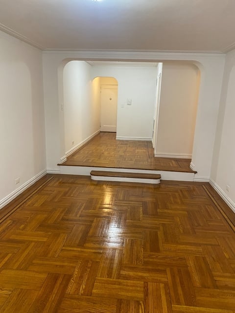
Welcome to 2226 Loring Place North, a building located in University Heights, West Bronx, Bronx in Bronx, NY.
As a quick overview, these are the most up-to-date information we've collected about the property.
The building itself was built in 1917.
From what we gather, there are a total 32 residential units.
Finally, 2226 Loring Place North was most recently sold on Apr 20, 2017 for $14,900,000.
The market value for the land that the building sits on has been listed at $84,000.
In addition, improvements upon the building have an added value of $930,000.
In total, the total market value of the property as a whole is $1,014,000.
According to local assessors, the total value of the building is currently valued at $620,100.
Specifically, the value of the land that the property sits on has been assessed at $37,800.
The building was last assessed in 2023.
Here's what we know about the features and amenities in this building.
While there is no garage access for residents, you will probably be able to find a local garage to park your car at instead.
We are not sure what system the building uses for cooling.
Sadly, informaton related to the heating system was not disclosed.
There is no porch or patio on the premise of the property.
For those who love to swim, you'll want to check out community pools nearby as this particular property does not have a swimming pool.
The local assessor's office has not provided us with information related to the roof cover material and the type of roof the building has.
More About The Building
In total, the building area is listed as 31,050 square feet.
To break it down, the depth of the building was measured at 95 square feet and the front is listed as 78 square feet.
In comparison, the lot area is listed as 9,416 square feet.
The depth of the property lot was measured at 128 square feet and the front at 79 square feet.
The building itself has 31,050 square footage of total floor area.
Out of that, 31,050 square footage of floor area is residential. The rest of the space could be utilized as commercial, garage, factory, or alternative use space.
Fun fact, were you aware that buildings can shift depending on temperatures outdoors? This might remind you of middle school science classes, but heat will cause most materials to expand while the cold will cause them to contract. As a result, many architects and engineers often have to make sure that control joints are made up of the right materials and in good condition.
The building class code for 2226 Loring Place North is unknown but given the importance of this information, we will work to update this data as soon as possible.
Interested in learning more about the neighborhood that the property is located in?
Buildings in the University Heights area have a median price of $2,104.
Those in the 25th percentile, have a price around $1,575.
While those in the 75th percentile, have a price around $2,630.
Typically, the buildings in this area have a median sqft of 879.
That means that the median price per sqft is around $3.
In other words, the price per sqft for buildings in the 25th percentile is $3.
While the price per sqft for buildings in the 75th percentile is $3.
As a breakdown, we've included the following stats:
- There are currently no studio listings being advertised in the area.
- There is currently a single advertised one bedroom listing.
- There are currently a total of 3 two bedroom listings.
The median price for these types of listings is $2,607.
That's $3.04 price per sqft.
- There are currently no three bedroom listings being advertised in the area.
- There are currently no four bedroom listings being advertised in the area.
About The Area
2226 Loring Place North is located in 10453.
There are 80,516 people living here.
There are 27,240 households.
Most of these households have an average family size of 3.61 people.
According to the census, 97% are currently renting while 3% own their homes.
The median age of this population is around 30.1 years old.
On average, most folks in the zipcode are unmarried.
About 73% of folks speak a language other than English in this area.
The area's employment rate is currently around 50.9%.
Speaking of employment, the median income is $22,914.
Most folks will commute by public transportation for around 41.7 minutes.
Finally, we know that 29% of residents in the area have graduated with their high school degree.
Additionally, 10% and 3% have their Bachelor's and Master's degree, respectfully.
Moving on to the county level.
Bronx County, New York has a population of 1,436,785 people.
Based on census records, there are 490,740 registered households.
Families in this area are on average made up of 3.56 people per household.
Most folks are unmarried.
They are also typically around 33.3 years old.
Does diversity matter to you? Right now, 59% of folks speak a language other than English here.
About 81% rent while 19% purchased their homes.
Right now, the community is made up of 27% of residents who have graduated with at least a high school degree.
On top of that, 13% have a Bachelor's degree and 7% have a Master's degree.
The employment rate is currently around 51.9%.
Those employed, have a median income of $35,302.
Finally, let's take a look at the stats related to New York - Newark, NY - NJ - CT Urban Area.
The urban area is home to 18,812,161 people.
A total of 6,707,347 households are registered here.
With average family sizes being listed at 3.42 people.
About 25% of residents have graduated with a high school degree.
Of the rest, 22% have their Bachelor's and 16% have their Master's degree.
Folks speaking a language other than English, make up about 40% of the population.
Speaking of your commute, 59.7% of people in this area are employed.
The recorded median income is currently at $68,319 per year.
The median population age has been listed at 37.8 years old.
Interestingly enough, unmarried people make up the majority of the population.
Last but not least, renters make up about 50% of the population while homeowners are at about 50% of the population.
PUBLIC TRANSIT
183 St
(0.33 mi - 8 min walk)
MTA New York City Transit
Burnside Av
(0.45 mi - 11 min walk)
MTA New York City Transit
Fordham Rd
(0.51 mi - 12 min walk)
MTA New York City Transit
182-183 Sts
(0.54 mi - 13 min walk)
MTA New York City Transit
207 St
(0.57 mi - 14 min walk)
MTA New York City Transit