1620 Ashurst Road, Philadelphia, PA 19151
Overbrook, West Philadelphia, Philadelphia
Nearby Active Listings
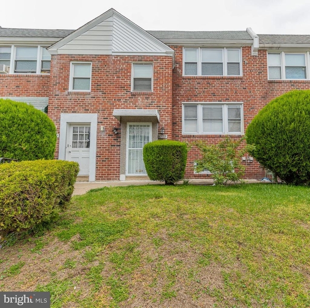
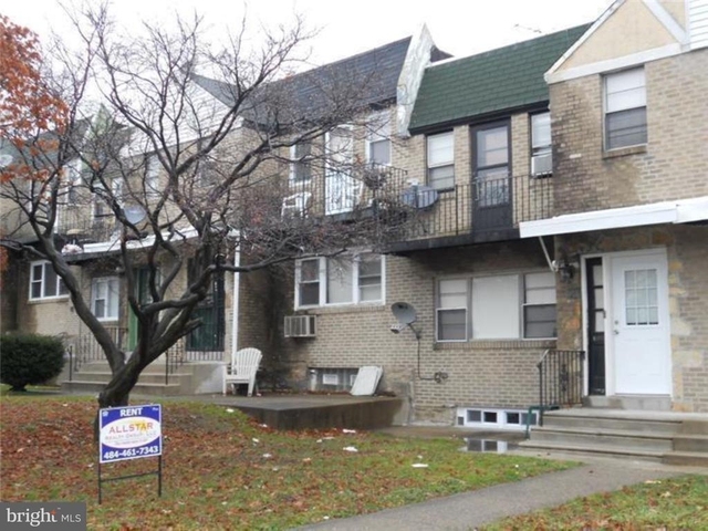
Welcome to 1620 Ashurst Road, a building located in Overbrook, West Philadelphia, Philadelphia in Philadelphia, PA.
As a quick overview, these are the most up-to-date information we've collected about the property.
The building itself was built in 1949.
There are a total of 2 floors.
Finally, 1620 Ashurst Road was most recently sold on Apr 30, 2010 for $24,186.
The market value for the land that the building sits on has been listed at $33,680.
In addition, improvements upon the building have an added value of $134,720.
In total, the total market value of the property as a whole is $168,400.
According to local assessors, the total value of the building is currently valued at $168,400.
Specifically, the value of the land that the property sits on has been assessed at $33,680.
The building was last assessed in 2023.
Here's what we know about the features and amenities in this building.
While there is no garage access for residents, you will probably be able to find a local garage to park your car at instead.
We are not sure what system the building uses for cooling.
Sadly, informaton related to the heating system was not disclosed.
There is no porch or patio on the premise of the property.
For those who love to swim, you'll want to check out community pools nearby as this particular property does not have a swimming pool.
The local assessor's office has not provided us with information related to the roof cover material and the type of roof the building has.
Facts
Effective Year Built
1949
Building Condition
Average
Construction Type
Masonry
Exterior Walls Type
Brick
Interior Walls Type
unknown
Basement Type
Partial basement
Garage Type
Underground/basement
Location Influence Type
unknown
Building
Property Class
Residential
Standard Land Use Code
Townhouse (residential)
County Land Use Code
Homestead (misc.)
State Land Use Code
Single family residential
Legal Description 1
2056 SE OF
Ownership
Current Owner
LEIDER DANIEL
Current Owner's Name
SHAMES ADAM R
Current Owner 2
SHAMES MARC
Current Owner 2's Name
SHAMES JONATHAN M
Previous Owner
LEIDER DANIEL
Previous Owner 2
SPILLER BRAD J
Owner Address - City
MEDIA
Owner Address - ZIP Code
19063
Second Owner First Name
JONATHAN
Second Owner Last Name
SHAMES
Second Owner Middle Name
M
Neighborhood
School District Name
Philadelphia City School District
School Tax School District
PHILADELPHIA SD
Census - Combined Statistical Area - Area Code
428
Census - Combined Statistical Area - Area Name
Philadelphia-Reading-Camden, PA-NJ-DE-MD
Census - County FIPS
42101
Census - Full FIPS
421010098022009
Census - Metropolitan Division - Area Code
37964
Census - Metropolitan Division - Area Name
Philadelphia, PA
Census - Metro Micro Statistical Area - Area Code
37980
Census - Metro Micro Statistical Area - Area Name
Philadelphia-Camden-Wilmington, PA-NJ-DE-MD
Census - Metro Micro Statistical Area - Area Type
metropolitan
Census - Place FIPS
4260000
Census Source
US Census Bureau
School District - Unified - Grade High
12
School District - Unified - Grade Low
PK
School District - Unified - LEA Code
4218990
School District - Unified - Name
Philadelphia City School District
Geography
Assessors Map Reference
066N120024
Municipality
PHILADELPHIA
Mailing Carrier Code
C069
Mailing Full Street Address
11 JONATHAN MORRIS CIR
Mailing Street
JONATHAN MORRIS
Mailing 4-Digit Zip Code
1069
Geo Status Code
Prior to setting the GEOsource field the default value was 'P'.
Valuation
Timestamp
2024-01-22 22:27:03
More About The Building
In total, the building area is listed as 1,120 square feet.
The depth of the property lot was measured at 920 square feet and the front at 160 square feet.
The building itself has 1,120 square footage of total floor area.
Fun fact, were you aware that buildings can shift depending on temperatures outdoors? This might remind you of middle school science classes, but heat will cause most materials to expand while the cold will cause them to contract. As a result, many architects and engineers often have to make sure that control joints are made up of the right materials and in good condition.
The building class code for 1620 Ashurst Road is unknown but given the importance of this information, we will work to update this data as soon as possible.
Interested in learning more about the neighborhood that the property is located in?
Buildings in the Overbrook area have a median price of $1,800.
Those in the 25th percentile, have a price around $1,350.
While those in the 75th percentile, have a price around $2,300.
Typically, the buildings in this area have a median sqft of 1,439.
That means that the median price per sqft is around $1.
In other words, the price per sqft for buildings in the 25th percentile is $1.
While the price per sqft for buildings in the 75th percentile is $2.
As a breakdown, we've included the following stats:
- There are currently a total of 2 studio listings.
The median price for these types of listings is $1,550.
That's $1.16 price per sqft.
- There are currently a total of 5 one bedroom listings.
The median price for these types of listings is $1,200.
That's $0.89 price per sqft.
- There are currently a total of 11 two bedroom listings.
The median price for these types of listings is $1,400.
That's $1.18 price per sqft.
- There are currently a total of 10 three bedroom listings.
The median price for these types of listings is $2,100.
That's $1.48 price per sqft.
- There are currently a total of 9 four bedroom listings.
The median price for these types of listings is $2,350.
That's $1.28 price per sqft.
About The Area
1620 Ashurst Road is located in Philadelphia County, Pennsylvania.
There are 1,559,938 people living here.
There are 582,594 households.
Most of these households have an average family size of 3.58 people.
According to the census, 48% are currently renting while 52% own their homes.
The median age of this population is around 33.9 years old.
On average, most folks in the county are unmarried.
About 22% of folks speak a language other than English in this area.
The area's employment rate is currently around 52.3%.
Speaking of employment, the median income is $39,770.
Most folks will commute by car for around 32.7 minutes.
Finally, we know that 34% of residents in the area have graduated with their high school degree.
Additionally, 15% and 11% have their Bachelor's and Master's degree, respectfully.
Moving on to the urban area level.
Philadelphia, PA - NJ - DE - MD Urban Area has a population of 5,512,461 people.
Based on census records, there are 2,044,033 registered households.
Families in this area are on average made up of 3.31 people per household.
Most folks are unmarried.
They are also typically around 38 years old.
Does diversity matter to you? Right now, 16% of folks speak a language other than English here.
About 34% rent while 66% purchased their homes.
Right now, the community is made up of 30% of residents who have graduated with at least a high school degree.
On top of that, 21% have a Bachelor's degree and 15% have a Master's degree.
The employment rate is currently around 59.5%.
Those employed, have a median income of $62,593.
If you move here, you can expect to commute mostly by car for around 29.1 minutes.
$1,550
Studio Median Rent
PUBLIC TRANSIT
77th St & Woodbine Av
(630 ft - 3 min walk)
SEPTA
77th St & Brookhaven Rd
(670 ft - 3 min walk)
SEPTA
77th St & Brookhaven Rd
(700 ft - 3 min walk)
SEPTA
Woodbine Av & 77th St
(710 ft - 3 min walk)
SEPTA
77th St & Sherwood Rd
(950 ft - 4 min walk)
SEPTA
Nearby Schools
(within attendance boundary)
7501 Woodbine Ave, Philadelphia, PA 19151
Public
•
Elementary
•
Grades PK to 8
Philadelphia City School District
3509 Spring Garden St, Philadelphia, PA 19104
Public
•
Middle School
•
Grades 5 to 7
Philadelphia City School District
5898 Lancaster Ave, Philadelphia, PA 19131
Public
•
High School
•
Grades 9 to 12
Philadelphia City School District
School zoning information and other data are provided by
RealtyHop Schools and 3rd party sources.
The contents of the database are not guaranteed to be accurate or timely.
Contact the schools or districts before making any decisions using on this data.