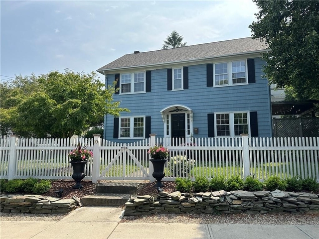
Welcome to 10 Malbone Road, a building located in Newport in Newport, RI.
As a quick overview, these are the most up-to-date information we've collected about the property.
The building itself was built in 1940.
There are a total of 2 floors.
Finally, 10 Malbone Road was most recently sold on Oct 15, 2020 for $3,600,000.
According to local assessors, the total value of the building is currently valued at $474,300.
Specifically, the value of the land that the property sits on has been assessed at $149,600.
The building was last assessed in 2023.
Here's what we know about the features and amenities in this building.
While there is no garage access for residents, you will probably be able to find a local garage to park your car at instead.
We are not sure what system the building uses for cooling.
Sadly, informaton related to the heating system was not disclosed.
There is no porch or patio on the premise of the property.
For those who love to swim, you'll want to check out community pools nearby as this particular property does not have a swimming pool.
The local assessor's office has not provided us with information related to the roof cover material and the type of roof the building has.
Facts
General
Year Built
1940
Effective Year Built
1987
Building Count
1
Total Rooms
9
Bedroom Count
4
Bathroom Count
2
Full Bathrooms
1
Partial Bathrooms
2
Building Condition
Good
Building Quality
unknown
Construction Type
Frame
Building Style
Colonial
Exterior Walls Type
Wood siding
Interior Walls Type
unknown
Roof Shape Type
Gable
Roof Cover Type
Asphalt
Floor Count
2
Living Units
1
Floor Cover
unknown
Basement Type
unknown
Basement Area
0
Garage Type
Detached
Parking Space Count
0
Patio Type
unknown
Porch Type
unknown
Pool Type
unknown
Unit Count
Building Floor Area
Floor Area Ratios
Building
Building Type
unknown
Property Class
Residential
Land Acres
0.168
Standard Land Use Code
Single family residential
County Land Use Code
unknown
Ownership
Current Owner
HILDEBRAND JAMES L
Current Owner's Name
BROWN DENNIS R
Current Owner 2's Name
NASTKE JAS
Previous Owner
E A SHERMAN PUBLISH CO
Previous Owner's Name
BROWN DENNIS R
Owner Address - City
NEWPORT
Owner Address - State
RI
Owner Address - ZIP Code
02840
Owner First Name
DENNIS
Owner Last Name
BROWN
Owner Middle Name
R
Second Owner First Name
JAS
Second Owner Last Name
NASTKE
Owner Before Previous Owner
REDLICH ANITA
Is Owner Occupied
Owner-occupied property
Neighborhood
School District Name
Newport School District
School Tax School District
NEWPORT PS
Census Tract
040500
Census Block Code
3010
Census Group
3
Census Year
2020
Census - Combined Statistical Area - Area Code
148
Census - Combined Statistical Area - Area Name
Boston-Worcester-Providence, MA-RI-NH-CT
Census - County FIPS
44005
Census - Full FIPS
440050405003010
Census - Metro Micro Statistical Area - Area Code
39300
Census - Metro Micro Statistical Area - Area Name
Providence-Warwick, RI-MA
Census - Metro Micro Statistical Area - Area Type
metropolitan
Census - Place FIPS
4449960
Census Source
US Census Bureau
Census State FIPS
44
Census Tract Code
040500
School District - Unified - Grade High
12
School District - Unified - Grade Low
PK
School District - Unified - LEA Code
4400720
School District - Unified - Name
Newport School District
Zoning
Zoning
R10
Geography
Account Number
R01704
Parcel
NEWP M:010 B:0211
Block
211
Lot Code
unknown
Municipality
NEWPORT
Latitude
41.4992
Longitude
-71.3079
FIPS
44005
Mailing Carrier Code
C024
Mailing Full Street Address
10 MALBONE RD
Mailing House Number
10
Mailing Street Mode
RD
Mailing Street
MALBONE
Mailing 4-Digit Zip Code
1744
Geo Status Code
Prior to setting the GEOsource field the default value was 'P'.
Valuation
Timestamp
2023-10-24 01:58:50
UCID Flag
C
More About The Building
In total, the building area is listed as 1,734 square feet.
The building itself has 3,474 square footage of total floor area.
Fun fact, were you aware that buildings can shift depending on temperatures outdoors? This might remind you of middle school science classes, but heat will cause most materials to expand while the cold will cause them to contract. As a result, many architects and engineers often have to make sure that control joints are made up of the right materials and in good condition.
The building class code for 10 Malbone Road is unknown but given the importance of this information, we will work to update this data as soon as possible.
Interested in learning more about the neighborhood that the property is located in?
Buildings in the 02840 area have a median price of $4,275.
Those in the 25th percentile, have a price around $3,000.
While those in the 75th percentile, have a price around $9,000.
Typically, the buildings in this area have a median sqft of 1,253.
That means that the median price per sqft is around $4.
In other words, the price per sqft for buildings in the 25th percentile is $3.
While the price per sqft for buildings in the 75th percentile is $7.
As a breakdown, we've included the following stats:
There is currently one advertised studio listing.
There are currently a total of 26 one bedroom listings.
The median price for these types of listings is $2,300.
That's $4.21 price per sqft.
There are currently a total of 88 two bedroom listings.
The median price for these types of listings is $3,250.
That's $3.45 price per sqft.
There are currently a total of 65 three bedroom listings.
The median price for these types of listings is $4,350.
That's $3.23 price per sqft.
There are currently a total of 58 four bedroom listings.
The median price for these types of listings is $12,000.
That's $5.06 price per sqft.
About The Area
-
Studio Median Rent
$2,300
1BR Median Rent
$3,250
2BR Median Rent
$4,350
3BR Median Rent
PUBLIC TRANSIT
60
63
BROADWAY OPP FRIENDSHIP(Under 500 ft - 3 min walk)
Rhode Island Public Transit Authority
60
63
BROADWAY BEFORE SUMMER(Under 500 ft - 3 min walk)
Rhode Island Public Transit Authority
60
63
BROADWAY BEFORE FRIENDSHIP(Under 500 ft - 3 min walk)
School zoning information and other data are provided by
RealtyHop Schools and 3rd party sources.
The contents of the database are not guaranteed to be accurate or timely.
Contact the schools or districts before making any decisions using on this data.