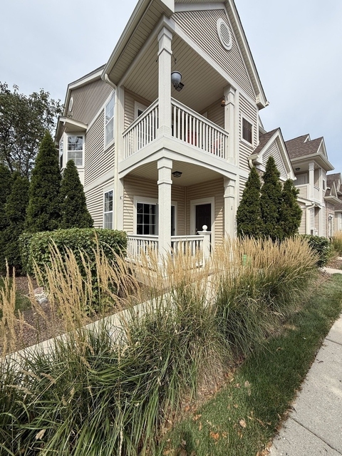
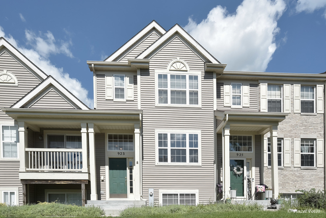
Welcome to 1065 Port Royal Road, a building located in Rutland in Hampshire, IL.
As a quick overview, these are the most up-to-date information we've collected about the property.
The building itself was built in 2006.
This is a relatively tall building with a total of 200 floors.
Finally, 1065 Port Royal Road was most recently sold on Apr 24, 2023 for $312,500.
The market value for the land that the building sits on has been listed at $77,014.
In addition, improvements upon the building have an added value of $170,249.
In total, the total market value of the property as a whole is $247,263.
According to local assessors, the total value of the building is currently valued at $82,388.
Specifically, the value of the land that the property sits on has been assessed at $25,661.
The building was last assessed in 2022.
Here's what we know about the features and amenities in this building.
Thankfully, there is a .
The building depends on for cooling.
Sadly, informaton related to the heating system was not disclosed.
The code designated for the basement in this building was 8 which stands for: "".
Are you a fan of fireplaces? Good news! This property has one single fireplace.
There is no porch or patio on the premise of the property.
For those who love to swim, you'll want to check out community pools nearby as this particular property does not have a swimming pool.
The local assessor's office has not provided us with information related to the roof cover material and the type of roof the building has.
More About The Building
In total, the building area is listed as 1,780 square feet.
The building itself has 2,860 square footage of total floor area.
Fun fact, were you aware that buildings can shift depending on temperatures outdoors? This might remind you of middle school science classes, but heat will cause most materials to expand while the cold will cause them to contract. As a result, many architects and engineers often have to make sure that control joints are made up of the right materials and in good condition.
The facade was constructed using .
The building class code for 1065 Port Royal Road is unknown but given the importance of this information, we will work to update this data as soon as possible.
Interested in learning more about the neighborhood that the property is located in?
Buildings in the 60140 area have a median price of $2,448.
Those in the 25th percentile, have a price around $2,025.
While those in the 75th percentile, have a price around $2,763.
Typically, the buildings in this area have a median sqft of 1,565.
That means that the median price per sqft is around $19.
In other words, the price per sqft for buildings in the 25th percentile is $17.
While the price per sqft for buildings in the 75th percentile is $22.
As a breakdown, we've included the following stats:
- There are currently no studio listings being advertised in the area.
- There are currently a total of 2 one bedroom listings.
The median price for these types of listings is $1,200.
That's $16.94 price per sqft.
- There are currently a total of 8 two bedroom listings.
The median price for these types of listings is $2,100.
That's $21.24 price per sqft.
- There are currently a total of 7 three bedroom listings.
The median price for these types of listings is $2,800.
That's $19.11 price per sqft.
- There is currently a single advertised four bedroom listing.
The median price for these types of listings is $6,000.
That's $12.73 price per sqft.
About The Area
1065 Port Royal Road is located in 60140.
There are 15,985 people living here.
There are 5,745 households.
Most of these households have an average family size of 3.08 people.
According to the census, 11% are currently renting while 89% own their homes.
The median age of this population is around 40.2 years old.
On average, most folks in the zipcode are married.
About 12% of folks speak a language other than English in this area.
The area's employment rate is currently around 67.6%.
Speaking of employment, the median income is $78,917.
Most folks will commute by car for around 37.6 minutes.
Finally, we know that 19% of residents in the area have graduated with their high school degree.
Additionally, 25% and 14% have their Bachelor's and Master's degree, respectfully.
Moving on to the county level.
Kane County, Illinois has a population of 526,615 people.
Based on census records, there are 173,718 registered households.
Families in this area are on average made up of 3.49 people per household.
Most folks are married.
They are also typically around 36.2 years old.
Does diversity matter to you? Right now, 32% of folks speak a language other than English here.
About 27% rent while 73% purchased their homes.
Right now, the community is made up of 23% of residents who have graduated with at least a high school degree.
On top of that, 21% have a Bachelor's degree and 11% have a Master's degree.
The employment rate is currently around 64.5%.
Those employed, have a median income of $71,602.





 Your Privacy Choices
