2161 Barnes Avenue, Bronx, NY 10462
Pelham Parkway, East Bronx, Bronx
6 Stories
72 Units
Built in 1931
Nearby Active Listings
By Christian Madalengoitia
Welcome to 2161 Barnes Avenue, a building located in Pelham Parkway, East Bronx, Bronx in Bronx, NY.
As a quick overview, these are the most up-to-date information we've collected about the property.
The building itself was built in 1931.
This is a relatively tall building with a total of 6 floors.
From what we gather, there are a total 72 residential units.
Finally, 2161 Barnes Avenue was most recently sold on Nov 1, 2004 for $5,900,000.
The market value for the land that the building sits on has been listed at $400,000.
In addition, improvements upon the building have an added value of $3,576,000.
In total, the total market value of the property as a whole is $3,976,000.
According to local assessors, the total value of the building is currently valued at $1,272,600.
Specifically, the value of the land that the property sits on has been assessed at $117,900.
The building was last assessed in 2023.
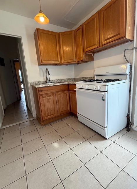
Here's what we know about the features and amenities in this building.
While there is no garage access for residents, you will probably be able to find a local garage to park your car at instead.
We are not sure what system the building uses for cooling.
Sadly, informaton related to the heating system was not disclosed.
There is no porch or patio on the premise of the property.
For those who love to swim, you'll want to check out community pools nearby as this particular property does not have a swimming pool.
The local assessor's office has not provided us with information related to the roof cover material and the type of roof the building has.
Facts
Effective Year Built
1931
Building Condition
unknown
Construction Type
unknown
Exterior Walls Type
unknown
Interior Walls Type
unknown
Residential Unit Count
72
Residential Building Floor Area
74,772
Building
Property Class
Residential
Standard Land Use Code
Apartment house (5+ units)
County Land Use Code
unknown
Sanborn Map Number
220 014
Neighborhood
Sanitation District Borough
2
School District Name
New York City Department Of Education
School Tax School District
BRONX
Census - Combined Statistical Area - Area Code
408
Census - Combined Statistical Area - Area Name
New York-Newark, NY-NJ-CT-PA
Census - County FIPS
36005
Census - Full FIPS
360050228003000
Census - Metropolitan Division - Area Code
35614
Census - Metropolitan Division - Area Name
New York-Jersey City-White Plains, NY-NJ
Census - Metro Micro Statistical Area - Area Code
35620
Census - Metro Micro Statistical Area - Area Name
New York-Newark-Jersey City, NY-NJ-PA
Census - Metro Micro Statistical Area - Area Type
metropolitan
Census - Place FIPS
3608510
Census Source
US Census Bureau
School District - Unified - Grade High
12
School District - Unified - Grade Low
PK
School District - Unified - LEA Code
3620580
School District - Unified - Name
New York City Department Of Education
Zoning
Split Boundary Zone Indicator
N
Geography
Account Number
2-04321-0058
Borough Block Lot
2043210058
Mailing Carrier Code
C025
Mailing Full Street Address
98 CUTTERMILL RD
Mailing Street
CUTTERMILL
Mailing 4-Digit Zip Code
3036
Geo Status Code
Prior to setting the GEOsource field the default value was 'P'.
Valuation
Timestamp
2024-01-30 19:52:51
More About The Building
In total, the building area is listed as 74,772 square feet.
To break it down, the depth of the building was measured at 76 square feet and the front is listed as 193 square feet.
In comparison, the lot area is listed as 20,008 square feet.
The depth of the property lot was measured at 100 square feet and the front at 200 square feet.
The building itself has 74,772 square footage of total floor area.
Out of that, 74,772 square footage of floor area is residential. The rest of the space could be utilized as commercial, garage, factory, or alternative use space.
Fun fact, were you aware that buildings can shift depending on temperatures outdoors? This might remind you of middle school science classes, but heat will cause most materials to expand while the cold will cause them to contract. As a result, many architects and engineers often have to make sure that control joints are made up of the right materials and in good condition.
The building class code for 2161 Barnes Avenue is unknown but given the importance of this information, we will work to update this data as soon as possible.
Interested in learning more about the neighborhood that the property is located in?
Buildings in the Pelham Parkway area have a median price of $1,800.
Those in the 25th percentile, have a price around $1,800.
While those in the 75th percentile, have a price around $1,800.
As a breakdown, we've included the following stats:
- There are currently no studio listings being advertised in the area.
- There is currently a single advertised one bedroom listing.
The median price for these types of listings is $1,800.
- There are currently no two bedroom listings being advertised in the area.
- There are currently no three bedroom listings being advertised in the area.
- There are currently no four bedroom listings being advertised in the area.
About The Area
2161 Barnes Avenue is located in 10462.
There are 78,725 people living here.
There are 29,438 households.
Most of these households have an average family size of 3.46 people.
According to the census, 78% are currently renting while 22% own their homes.
The median age of this population is around 35.1 years old.
On average, most folks in the zipcode are unmarried.
About 58% of folks speak a language other than English in this area.
The area's employment rate is currently around 59.3%.
Speaking of employment, the median income is $48,315.
Most folks will commute by public transportation for around 46.4 minutes.
Finally, we know that 28% of residents in the area have graduated with their high school degree.
Additionally, 16% and 9% have their Bachelor's and Master's degree, respectfully.
Moving on to the county level.
Bronx County, New York has a population of 1,436,785 people.
Based on census records, there are 490,740 registered households.
Families in this area are on average made up of 3.56 people per household.
Most folks are unmarried.
They are also typically around 33.3 years old.
Does diversity matter to you? Right now, 59% of folks speak a language other than English here.
About 81% rent while 19% purchased their homes.
Right now, the community is made up of 27% of residents who have graduated with at least a high school degree.
On top of that, 13% have a Bachelor's degree and 7% have a Master's degree.
The employment rate is currently around 51.9%.
Those employed, have a median income of $35,302.
Finally, let's take a look at the stats related to New York - Newark, NY - NJ - CT Urban Area.
The urban area is home to 18,812,161 people.
A total of 6,707,347 households are registered here.
With average family sizes being listed at 3.42 people.
About 25% of residents have graduated with a high school degree.
Of the rest, 22% have their Bachelor's and 16% have their Master's degree.
Folks speaking a language other than English, make up about 40% of the population.
Speaking of your commute, 59.7% of people in this area are employed.
The recorded median income is currently at $68,319 per year.
The median population age has been listed at 37.8 years old.
Interestingly enough, unmarried people make up the majority of the population.
Last but not least, renters make up about 50% of the population while homeowners are at about 50% of the population.